Today, Thursday, Sept. 23, around 3:30pm we arrived back in Bolton.
We knew we were back in Canada when...we passed over the bridge into Sarnia from Port Huron and went through Canada Customs. No hassles, very pleasant Customs officer who appreciated it had been a looooong trip. How long? 22,283km over 73 days!
We knew we were back in Canada when...we were looking for a Tim Horton's to find a washroom and a coffee (I had an Ice Cappuccino - my first of the year! - it was that warm in southern Ontario).
We knew we were back in Canada when...we again saw all the huge garbage toting trucks heading to Michigan with Toronto's garbage and then returning empty - there just has to be a better way. Think of all the costs for roads, trucks, air quality.
We knew we were back in Canada when... we saw all the fall colours in the trees - reds, yellows, oranges mixed in with the green. Vibrant by the time we reached Toronto area.
We found the drive from The Badlands in South Dakota back to Ontario to be 3 days of "just driving" on I (Interstate) highways. Quite mind numbing, not to mention bum numbing! We had one day of solid rain - we moved with the storm mostly across Iowa. The drive across Illinois past Chicago and up to Flint, Michigan was very slow with lots of construction and delays because of 2 serious accidents, at least one fatal.
I don't seem to be able to upload the pictures from this computer so they will have to wait for Graeme's visit on Sunday.
The most used clothing? For Barb a pair of black, knee length shorts. They went with every t-shirt and never showed the dirt! For Laurie, blue jeans.
The clothing that never was pulled out of the camper - the down vest. It was warm when we were in the Arctic! Colder in Vernon - the Okanagan Valley in late August and in S. Dakota for 1 night. Only used the bug jackets once - the bugs were not a problem, even in northern BC and Yukon.
Regrets? Barb didn't savour the tranquility of the dry camp we did at the Arctic Circle enough. It was a beautiful night, and so peaceful. I was having some issues with the fact that we had lost the steps to the camper, so getting in/out was a major leap, and I was grumpy! I also regret we didn't have longer to visit the Badlands and that we missed Valdez in Alaska. Choices were made. And we didn't play enough golf! We also missed a few family members - Laurie's sister and family in the Calgary area. And many folks in the Vancouver/ Vancouver Island areas.
Things to check off the bucket list:
-Chicken Alaska (Laurie's list - we won't ever have to go back)
-Dempster Highway, northern B.C., Yukon and NWT - likely won't do it again and it was a hi-lite - would love to go back and hike in Tombstone Territorial Park.
-Alaska - didn't get to spend enough time in Denali Park, didn't get to Valdez but did see and do a lot, including Glaciers, bears, whales, eagles, Caribou and Musk Ox (Fairbanks, Anchorage, Seward)
-Cassiar-Stewart Highway - including Hyder and Grizzly Bears!
-Alaska highway from start to finish - loved Liard Hotsprings, White river campground,
-West coast of Washington - Cape Flattery - Pacific beaches
-Columbia River Canyon
-Yellowstone Nat'l Park - Old faithful
- Shell Canyon
-Cody, Wyoming and the shoot out with Buffalo Bill, Wyatt Earp and Wild Bill Hiccock
- Wall Drug store
- The Badlands of S. Dakota
Laurie and I played cribbage almost every night - we see-sawed and it finally came down to Barb being one up. We are still talking to each other - and have noticed that often we don't have to say more than 1 word, we're both thinking the same thing!
It's great to be home, the house seems huge (after living in an 8x10 camper for 2.5 months!
Stay tuned for the next adventure - Santa Fe, Taos, Grand Canyon....
Thursday, September 23, 2010
Tuesday, September 21, 2010
Map Update
It's been quite a while since I posted a map for Mum and Dad, I ended up having to rebuild it, as I ran into the max number of points.
View Mum and Dad 2. in a larger map
View Mum and Dad 2. in a larger map
Badlands to Sioux City


This morning we reluctantly left the Badlands. We plan to return, especially to the State campsite, as it has such interesting programs. There were fossil walks and geology walks that sounded pretty interesting.
We drove all day across S. Dakota with a fierce headwind the whole way. Quite tiring with the constant buffeting. We crossed over the Missouri River and then followed it from Sioux Falls down to Sioux City (Iowa). There were miles and miles and miles of corn fields.

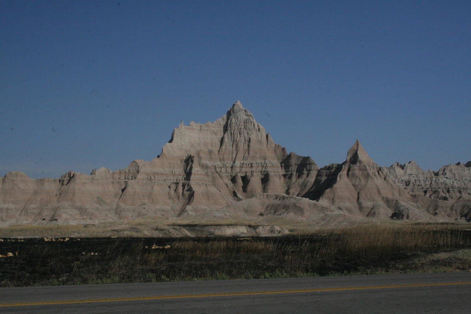
Badlands 4


Laurie actually got me to smile by saying "just take another step back"! The colours were spectacular. Wanted you to see the campsite was right beside some of the mountains. That night the ranger did an excellent presentation about stars and galaxies and he also had 3 different, huge telescopes so we could see Jupiter and all 4 moons, Antares and a double star, that I didn't catch the name of. It was very cool - as in cold, I had 4 layers on, but really cool as in interesting.


The Badlands


More goats!
We were driving through the Badlands late in the day, so the shadows were getting deeper. It was quite chilly- with a strong wind.
Monday, September 20, 2010
Wall Drug to the Badlands


Laurie had planned to go to Wall Drug from the beginning of the trip. He says that signs for Wall drug are all over the world ("11,253 miles to Wall Drug" from say Moscow). So we did stop at the town of Wall, and the store now covers about 2 blocks, and carries everything from clothes to jewelry, to knives and ice cream - and everything in between.
Then we proceeded to the S. Dakota Badlands. We were in awe. The S.D. Badlands State Park is extremely well done. There are plenty of turn outs to see a new vista, and there were many! We wound our way through the Park, and took about 100 pictures, but i will only bore you with a few.
Mount Rushmore


So, Mount Rushmore is really quite impressive. The fact that this took 15 years to carve into the face of a mountain with pretty basic tools (and a lot of blasting) with no deaths was also amazing. The workers were mostly working in bosun chairs, dangling from the top and winched up and down into place. They had plaster models to work from, and apparently the sculptor was very exacting and hands on.
The site was jazzed up with flags of the states but not heavily patriotic.
the third picture is interesting don't you think? Laurie has some ideas about the visage on the L.
Mount Rushmore


The northern part of Custer State Park led us to Mount Rushmore. We had to check our height as some of the tunnels were very low and narrow! One section was too low for us to take. It was a pretty trip, twisty-twiney through the woods - up hill and down dale. Eventually we came out to Mount Rushmore.
Map and things I have learned on this trip so far
Thanks Graeme for updating the map. Its pretty amazing to look at. Blog readers can find it by looking at Graeme's comment from the Sheridan blog.
I have also learned these things.
1. When going to the shower, make sure you have your toiletries(shampoo, soap..), clean clothes, and most importantly - your towel. Drying yourself with your dirty clothes doesn't really work!
2. Although shampoo and body lotion are in similar containers, body lotion does not work well for shampooing one's hair!
3. When at a new campsite, learn the washroom code before you run all the way across the campgrounds to the washroom!
Custer State Park 3


Another stag pronged antelope and when was the last time you heard from Smokey the Bear? It wasn't smoke - but fog!


Custer


We arrived early into Custer, S. Dakota. So we got our campsite organized and then went in to Custer to explore. Laurie remembered being here years ago and thought the town was quite interesting. It was Sunday, and certainly off peak season, and quite chilly, many of the shops were closed. Not very special but fun to poke about. We decided to explore some of Custar state park - the wildlife route - but as you can see from the pix, we ran into a heavy fog! And while we were supposed to see a lot of buffalo - instead we were held up by a herd of asses! Laurie had read somewhere that they will block traffic for a long while to see if someone will give them some treats! Not us!
Saturday, September 18, 2010
The road to Sheridan


As we passed over the summit, we found that we were above the clouds but soon entered into them. The red pavement lead us down at 8% grades for 11 miles!
Laurie figures we have now done 19,844 km on this trip!
Shell Canyon 2


This is but a few of the pictures we took on the trip through the canyon. The little river/falls were sort of anticlimactic. The so named pyramid peak is pretty obvious.
Shell Canyon
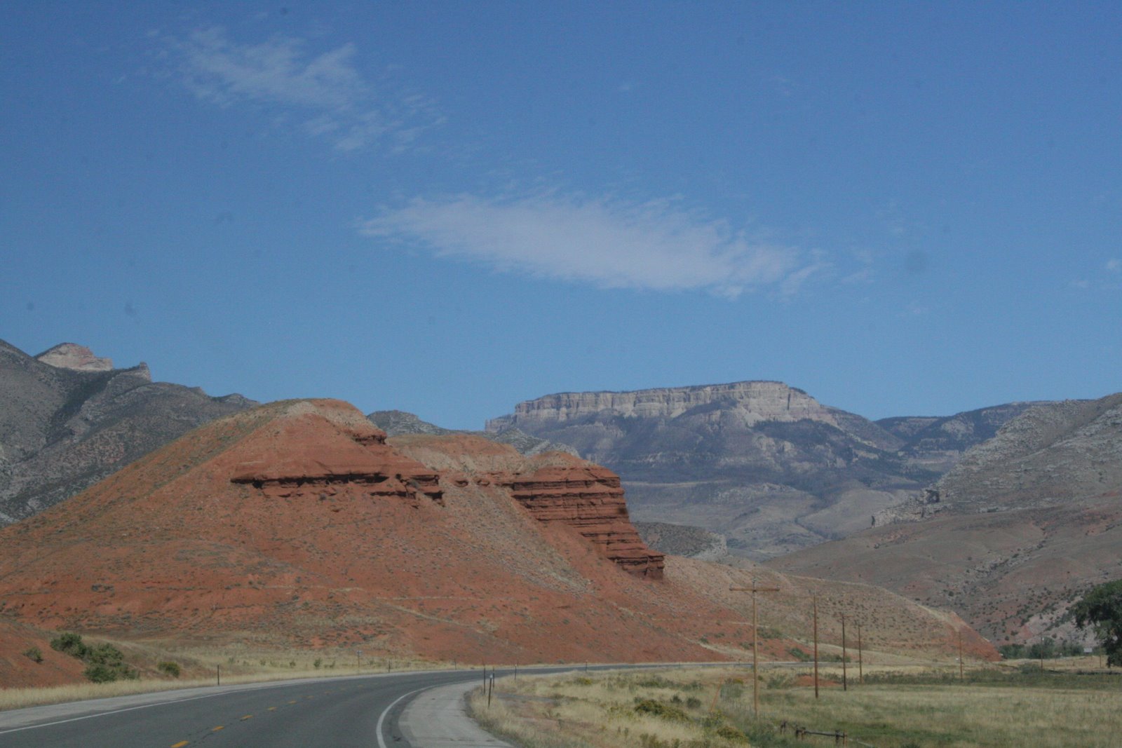


The shell river runs through this magnificent canyon, caused by shifting land masses. It was a twisty turny road, but each turn brought new vistas. The truck climbed steadily, the top pass was 9000 feet. At least we knew we had new brakes.
Subscribe to:
Posts (Atom)