Wednesday, May 31, 2017

Arizona landscape


The landscape across Arizona is remarkable as it changes every time you climb a hill or turn a corner.  These pictures give you a taste of some of the views as we traveled along.  They were mostly shot while in transit, but you get the idea.

North Rim of the Grand Canyon

So, we have had this on our bucket list for about 10 years now.  Tried to get there once but the road was closed (snow).   But we should have known from our experiences in the past week, that Memorial Day weekend is not the time to visit any National Park.  We left Tuba City after refreshing our bodies with showers, clothes with laundry facilities and souls with wifi and catching up with the world.  We arrived in Jacob's Lake about 11:00 and found a campsite.  We were still about 50 miles to the North Rim but figured we were unlikely to get a campsite any closer.
 We hiked out to the angel point along with a gazillion others, jostled for a picture and then headed back to explore the lodge.  The entire area was full to overflowing, we actually had to park about 1.5 km down the road and hike back.  We then hiked along the rim trail and enjoyed the view and the sunshine.
 Even though we had been told that the North Rim was even better than the south rim, we were somewhat disappointed.  I remember the South Rim leaving me in awe, you could see the Colorado River waaayyyy down at the bottom of the gorge and wave upon wave of incredibly colourful rock formations.  We stayed about 3 hours, and then got tired of the crowds and crazy people.
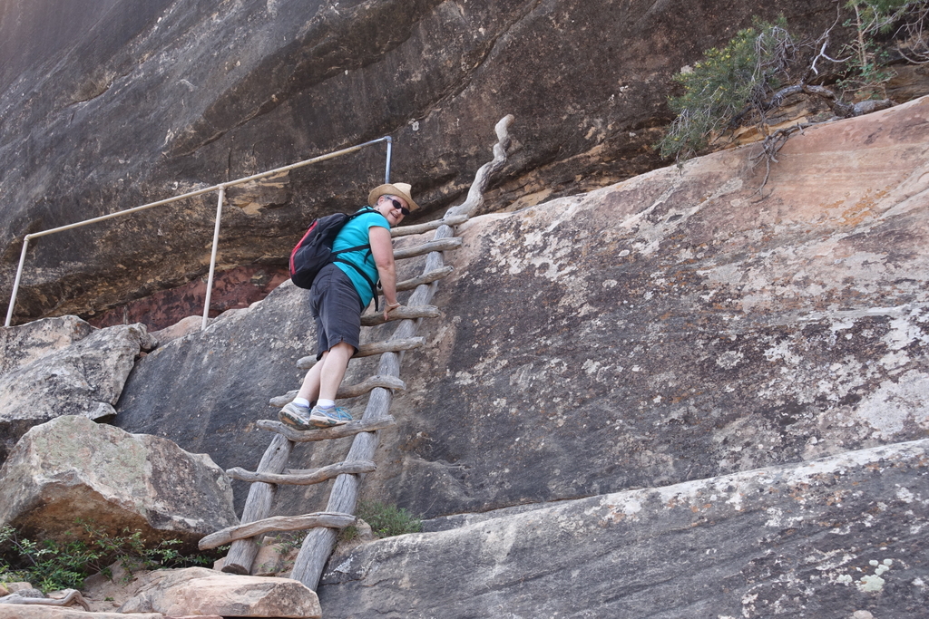
Did I mention that I have become very nervous about heights - and some of the view points have sheer drops - my red alert system was really humming.

Saturday, May 27, 2017

Canyon de chelly 3

 This is from the rim, looking down at Spider Rock.  Beautiful, peaceful, spiritual place.
 Now you can see the White House ruins from the canyon rim.  Can you see the jeeps in the picture?
From Canyon de Chelly, we headed to Hubble's Trading Post in Ganada, and then due west across miles and miles of flat desert with sagebrush.  Occasionally we would find ourselves circling another canyon  and then through Hopi country.  

Canyon de Chelly 2

 This shows the jeep ahead of us in the "overhang".
 This is the "white house" cliff dwelling, in the next post you will see this area from the rim of the canyon.

More pictographs, quite remarkable!

Canyon de Chelly 1

Canyon de Chelly is deep in Navajo country, and this canyon houses current Navajo families (who farm here in the summer) and many of the ancestors of the Anasazi (cliff dwellings and petroglyphs).
We booked ourselves onto a guided jeep tour into the valley yesterday and then did the overlooks today before we carried on to Tuba City.
We were in an open air vehicle driven by Harold, who is Navajo and very knowledgeable.  Only certified guides are allowed into the Canyon.  The drive was somewhat hair raising as we traveled through rivers, mud, sandy, rutted pathways, with many stops to see the highlights.   The neat thing was that Harold used a small hand mirror to draw out attention to the pictographs and petroglyphs along the canyon walls.  We also visited several Anasazi cliff dwellings, and although we were not actually allowed into them, we could still get quite close.


More from Natural arches

Also at Natural Arches, we saw many lizards, the biggest about 12 inches.  And we noted that there is a lot of green trim on these dry hills.  Several cacti blooming.  It's amazing how tenacious some of these plants are in pretty hostile, dry conditions.


Natural Arches National Monument

We left Hanksville, and headed east and then South to Canyon de Chelly.  On the way we stopped at Natural Arches, (not Arches, near Moab).


As you can see, there were several hikes involved to get down to the bottom of the arches.  Yes, I did the ladder and survived!   It was quite hot but the hike was exhilarating, and the quiet at the bottom of the arch was remarkable.

Wednesday, May 24, 2017

Hanksville, Utah

We toured the entire length of Bryce Canyon National Park southwards to Rainbow point and did one more short hike to another lookout.  All spectacular.  The weather is perfect, about 20 degrees C


By the way, you can click on a picture to enlarge it (at least it works on my lappy).
We left Bryce and headed eastwards along Highway 12 and then 24, passing through Grand Stair Case-Escalante and Capitol Reef National Park.  We had planned to stay at Capitol Reef but it was full so carried on to Hanksville.  The landscape has had many variations, formations and colours.  Also slick rock made us think of Graeme and his mountain biking - he'd have loved some of these landscapes.  Actually many bicyclists and motorcylists and a gazillion RVs on the road.   Here in Hanksville, it was 32 degrees C and really dry and windy.  The best part was finding this lovely campsite Duke's Slickrock Campground and RV - really nice with Duke's grill providing a great dinner.  We're plugged in, have great wifi and air conditioning.  Life is good.  As Laurie says, anything named Slick can't be bad!

Tuesday, May 23, 2017

Bryce Canyon

Yesterday we left Salt Lake City and tried to get to Cedar Breaks National Park, alas the road was closed, so we detoured and tried again, same problem.  Gave up and headed to Bryce Canyon.


It is impossible to find the right words to describe Bryce Canyon - spectacular doesn't really do it.  It is just surreal,  Many, many hoodoos, and formations.  They have now set up a shuttle bus that runs every 10 minutes from an external (to the park) parking area and campsite, and all the view points.  It works really well.  For instance we hiked for about 3 hours in and amongst the hoodoos (yes, Susan, we did the Navajo trail and the queens garden) then caught a bus to the visitors centre for some sit down time at their video.  Then caught the bus again and went to Bryce Point and walked the rim trail down to Inspiration point.  Now very tired, caught the bus back to the campsite!  Perfect, no driving or fussing with camper.  The campsites are full, the trails busy, 17 tour buses as well - yikes, we thought this would be a quiet time to visit.  Heading towards canyon de Chelly tomorrow.

Sunday, May 21, 2017

Salt Lake City, Utah

Arrived at the Salt Lake City KOA Sunday afternoon around 2:00 - had missed the free shuttle into town however, decided to take the LRT which was just across the street.  Super clean, quiet and efficient (ran on tracks and had hydro lines).
Laurie's hair is a little more curly (from sitting in two churches) as we toured much of the Temple of the Latter Day Saints (Church of Mormons).  Two lovely young "sisters" toured us through and around the buildings - they were unbelievably full of data and fervent enthusiasm for their church.  Beautiful flowers, statues and buildings - and the acoustics were amazing.  They have a model of the inside of the temple (which the public cannot access) which was quite interesting too.  Free books of Mormon at the ready!
The organ has thousands of pipes, and only 5 people are trained to play it.  This is where the Mormon Tabernacle choir sings.

Saturday Perrine Bridge, Twin Falls Idaho

We left Craters of the Moon and headed south west to Twin Falls, Idaho as Laurie had heard about the Perrine Bridge over the Snake River.  This is just a hop, skip and a jump away from where Evil Kneivel tried unsuccessfully to rocket/motorcycle jump the snake river.  The bridge is very high (550') above the river, and there are pathways and view points on either side, and you are permitted to walk across (protected walkways) or....jump!  People were doing BASE jumping off the middle of the bridge, and parachuting down to the bottom.  In fact, as we walked across, one woman did jump, and landed in the river - all the others had maneuvered their landing to a wide strip of land along the side.
On the other side of the bridge, deep in the gorge was a beautiful golf course.


This is the campsite, surrounded by surface of the moon!  This place is fantastic, even the walkways (to protect the lava formations) have little animal paw prints embossed in the surfaces.  Neat!

Formation that we walked to from the campsite, about 30 feet high

This is one of the cones we climbed - can you see the camper waaaayy down in the parking lot.  The entire mountain is cinders and it makes an interesting and loud crunch with every step.  Then we hiked up to the edge of this caldera - very impressive.


This trail led to caves and tube formations.  The entire area reminded me of the clinkers we used to find in the old coal furnace in our house on 39th avenue in Vernon.  (Okay, that was a looong time ago.)

Craters of the Moon National Monument

We left Bellvue and headed south east to Craters of the Moon National Monument.  We were there by 4:30 and managed to find a campsite right in the park, in the midst of the lava, cinders and rocks. Crazy formations, volcano cones, caves, rifts and domes .We hiked and explored a little that evening and much of Saturday.

Idaho contingent

Here are more pictures of Rob, Laura and family.


Days 3 & 4 again

Last night I worked on my Blog and wrote lovely stories....today they are gone - sigh- starting all over again.
Our campsite at Mountain Home (Mountain Home RV) was lovely, and a short walk to restaurants and a dollar store - whee.
We found we had a small leak below the sink in the bathroom, which my handy man had fixed in short order.
Headed over towards Sun Valley ski resort, but stopped short in Bellvue to have a super visit with family - Rob, Laura, Sydney, Lilly and Graham Morison.  They are a beautiful, busy,  family in a lovely little town.  We had coffee and home made muffins (yum, and thanks) and then had lunch out.  Drove the back road (saw 2 elk) up to Hailey to pick up the girls at school.  Even got to meet Wallace the scotty dog (who liked to go down the slide), and two nephews.   Great visit,


Friday, May 19, 2017

Laurie

Yesterday just before we got to Boise, I saw a young golden eagle score a very small mouse or mole.  Neat to watch.  We also crossed over the 45th parallel which means we are half way to the equator from the north pole and crossed over 4 creases on our map.

Thursday, May 18, 2017

2 Mountain Home, Idaho

Longish drive today, and 1 hour time zone change - but uneventful trip.  Amazing how much of Washington and Oregon are just like the Okanagan valley.  Hills covered with velvet of new growth but otherwise barren.    Lots of speeders (we think) pulled over by the police.  Otherwise quite a boring drive.  Sometimes boring is good - no hitches.  Lots of vineyards around Yakima, and several acres of solar panels near Boise.  Some hillsides sporting windmills.  Crossed the Snake and the Columbia rivers.  Both appear to be very high.
Sorry, no pictures.

Wednesday, May 17, 2017

2017 Day 1 Yakima

Easy day today.  Got away by 9:30, crossed the border without much ado, and traveled south.  Took a picture of the metal "picture window" sculpture just as you leave the US Border kiosks - it always amazes me.

I wonder how my garden will be when we get back - the clematis is loaded with buds, but no blooms as yet.  The rhododendrons are magnificent.

Very nice campsite, in an RV Park.

Went to Fred Meyers and got "stocked up".  On to Idaho tomorrow.